 |
 Up
Up
|
|

|

|
Lieutenant Brenske’s Marsch-Zirkel |
|
|
|
|
|
|
Have you ever felt the lack of a
Marsch-Zirkel in your life? Probably not... but Carl Brenske had,
and being an enterprising guy, he rolled his sleeves and proceeded
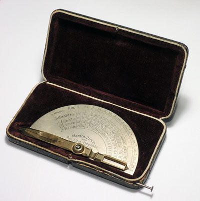
to invent one. The Marsch-Zirkel (“March Compasses”) is a simple member of the class of “graphical-numerical” computing devices, of which the Gerber Variable Scale is a more sophisticated example. It converts distances on a map into the time it would take to cover the corresponding real world distance with a troop of infantry or cavalry, and does it directly – as directly as it gets, in fact. Just open the compass points to the distance on the map, and read the time on the appropriate scale in the cursor’s window – there are scales for infantry, and for cavalry at a walk, trot or |
|
|
|
gallop. The distance in kilometers is shown as well. Wait, you say – surely this depends on the map’s scale? And of course, it does; the device has two sets of scales on its two sides, one for a scale of 1:100,000, the other for 1:80,000; presumably these were the most commonly used maps at the time (and they are, indeed, a sensible choice for troops in motion). |
|
|
|
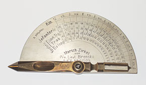
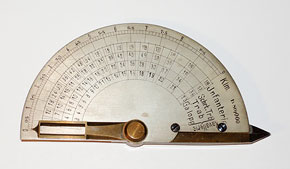 Click a photo to enlarge |
|
|
|
Once you see it, the device is straightforward and self-explanatory. Just as obvious is the quality of its construction: the steel tips fitted on the brass compass legs, the heavy scale plate, the precisely made hinge that ensures smooth motion. This is a well-made measuring tool, and it comes in a nice velvet-padded case too! A sticker on the bottom of the case identifies one Edmund Braune in Berlin as the |
|
|
|
distributor; the address, 114 Königgrätzer Straße, times it as pre-1915, when that street was renamed to Budapester Straße (Ebertstraße today). |

 Click a photo to enlarge |
|
|
|
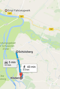
So let’s give it a try: assume you need to get your infantry platoon from Schützberg to Klöden, two German villages on the east bank of the Elbe near Wittenberg. You point the compasses at these two villages on this 1:100,000 reprint of an old (1908) German map of the area. As you see, the Marsch-Zirkel translates the distance to 3 km, and indicates it will be a 36 minute march. |
|
|
|
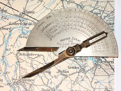
 Click a photo to enlarge |
|
|
|
And on the right is the solution given for
the same trek by Google Maps, which puts it at 3.5 km and 43 minutes
on foot. Both come to about 5 km/h, a reasonable if brisk pace; but
Google assumes a slightly longer path following the outline of the
road, while the Marsch-Zirkel measures a straight line. As for the
cavalry, we are told by the Marsch-Zirkel that they could cover the
distance – at a gallop – in eight minutes; but had they had a motor
car, Google tells us, they could have done it in five. Of Herr Brenske we know little. On his tool he is called “Prm. Lieut. Brenske”. The rank stands for Premier (First) Lieutenant; and we know his first name was Carl, from the German patent granted him on August 30th, 1891. His creation is ingenious and elegant, so he must have been smart as well as enterprising; but we know nothing more of him. The reason you never feel the lack of a Marsch-Zirkel in your life may be that today we have GPS, and Google Maps, and Waze... but Carl Brenske’s unique device, though less precise, is much lovelier! |
|
|
|
Exhibit provenance: From an American seller on Fleaglass, a site full of wonderful scientific antiques. More info: |
|
|
|
|
|
|
|
Home | HOC | Fractals | Miscellany | About | Contact Copyright © 2017 N. Zeldes. All rights reserved. |
|
